About
Why the Earth works the way it does
Grasp Geo makes animated videos that explain the physical "why" behind our planet: why continents drift, why the ground under cities sinks, and why rivers, rocks and water behave the way they do.
How we make our maps
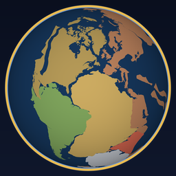
Our continent animations are built from published plate reconstructions, the same kind of models geologists use to work out where the continents sat millions of years ago. When a scene shows an idea that can't be mapped precisely, such as a future supercontinent, we label it as a simplified illustration.
What's coming
We publish three series. Sinking Cities explains why the ground under the world's cities is moving, starting with America's 28 biggest. Earth Through Time follows the continents, from Pangaea to the Ring of Fire and beyond. America's Lifelines looks at the rivers, aquifers and canals the country depends on, starting with the Mississippi. Subscribe on YouTube to see each new episode first.