Video coming soon
This story is coming to the Grasp Geo YouTube channel, worked out step by step on the map. Subscribe and you'll see it the day it goes live.
Subscribe on YouTubeThe corner of Clay and Sansome Streets is in the middle of San Francisco's Financial District. It has office towers, busy sidewalks and traffic. And under the pavement, there's a ship.
It isn't a model. It's a real sailing ship from the California Gold Rush, the Niantic. Its remains have been uncovered here more than once, most recently in 1978, when part of its stern was saved. It isn't alone: dozens of Gold Rush ships lie buried under downtown streets, blocks from today's waterfront.
Guess first: How does a ship end up under a downtown street, blocks from the water?
There's only one answer that works: when these ships arrived, this street was water. Much of downtown San Francisco is built on land that used to be the bay, and that land is sinking.
You might expect the culprit to be earthquakes, or the groundwater pumping we found in Houston. But in the parts of San Francisco built over the old bay, much of the sinking comes from something simpler: the ground is made of mud, and we've piled a city on top of it.
Let's work it out with three hard questions. How can a city's ground keep sinking for decades? Why did one of San Francisco's newest skyscrapers sink about three times more than its engineers expected? And which parts of the city sit on the weakest ground?
Hard question 1How can a city's ground keep sinking for decades?
To understand the sinking, we have to go back to 1849.
Gold had been found in California. Ships poured into San Francisco by the hundreds, and the moment they dropped anchor, many of their crews ran off to the gold fields. The shallow cove at the edge of town, Yerba Buena Cove, filled with abandoned ships. With no crews to sail them, people found other uses. The Niantic was hauled ashore and became a store, a warehouse and then a hotel.
Meanwhile, the booming town was desperate for flat land near the water. So it made some. People dumped sand, mud and rubble into the cove, right around the beached ships. Within about a year, the Niantic sat more than three blocks from the water.
Here's the problem with land made this way. Under the fill lies bay mud: soft clay that settled to the bottom of the bay over thousands of years. It's soaked with water. Put weight on it, from fill, streets or buildings, and the mud slowly squeezes. Water is pushed out from between the clay flakes, the layer gets thinner, and the ground on top drops. Engineers call this consolidation.
It's the same squeeze we saw under Houston, from the other direction. In Houston, pumping took water out from below. In San Francisco, weight presses it out from above.
So why does it go on for decades? Because mud is so fine and tight that water can barely move through it. To escape, each drop has to work its way to the top or bottom of the layer, and the thicker the layer, the longer that trip. Soil engineers have a simple rule for it: the time to settle grows with the square of the layer's thickness.
Three times as thick → 3 × 3 = 9 times as long
If a 10-foot layer takes 5 years to settle most of the way, a 30-foot layer takes about 9 × 5 = 45 years
That's why ground over deep bay mud doesn't sink once and stop. It keeps settling, year after year, long after the buildings are finished.
The takeaway: much of downtown sits on fill over soft, water-filled bay mud. The weight on top squeezes water out of the mud, slowly, and thick mud takes decades to finish.
Hard question 2Why did a modern skyscraper sink three times more than predicted?
This isn't only a Gold Rush story. One of San Francisco's newest towers ran into the same mud.
The Millennium Tower is 58 stories and about 645 feet tall. When it was finished in 2009, it was the tallest residential building in the city. Engineers expected it to settle roughly four to six inches over its lifetime, which is normal for a heavy building. By 2016, it had sunk about 16 inches, and it was still going at roughly two inches a year. It was sinking about three times more than predicted.
It also began to lean. Over its first fifteen years, the top tilted toward the northwest.
Guess first: How far do you think the top of the tower leaned? An inch? A foot? More?
About 30 inches. That sounds alarming, so let's work out what it means:
30 ÷ 7,740 ≈ 0.004 → an angle of about 0.2°
The Leaning Tower of Pisa leans about 4°, roughly twenty times more
You'd never see 0.2° with your eyes. But in a tall building, small angles matter for elevators, plumbing, and the people who live there.
So why did a carefully engineered building do this? It comes down to what it was standing on. Tall buildings rest on long columns driven into the ground, called piles, and engineers have two broad choices:
- End-bearing piles go all the way down to solid rock. The building stands on stone, like a table with its legs on the floor.
- Friction piles stop partway down, in firm-enough soil, and the soil gripping their sides holds the building up. This can work well, and it costs much less. But the building then rests on soil, not rock.
The Millennium Tower used friction piles reaching roughly 60 to 90 feet down.
Guess first: How deep would the piles have had to go to reach solid rock? Another ten feet? Fifty?
About 220 feet.
220 ÷ 60 ≈ 3.7
The rock was roughly 2½ to 4 times deeper than the piles went
Between the pile tips and that rock lay deeper clay that could still compress. So the tower's enormous weight kept pressing on ground that could still squeeze. It's hard question 1 all over again: weight on top, water slowly leaving the clay below. In a sense, the tower wasn't standing on the ground. It was floating in it.
There was a long debate over how much nearby construction and groundwater pumping added to the sinking. But the engineering lesson is clear either way: the tower's weight never reached solid rock.
The fix followed from the physics. Engineers drilled 18 new piles along the edge of the tower, all the way down and more than 30 feet into the rock, then shifted part of the building's weight onto them. Once the weight was transferred, in 2023, the sinking stopped, and the tower even rose very slightly. The lean is expected to ease slowly over many years.
The takeaway: the tower rested on soil, with compressible clay below and rock about 220 feet down. Its weight kept squeezing that clay until engineers connected it to the rock.
Hard question 3Where is San Francisco's ground weakest?
Now we can make a prediction of our own. If the trouble comes from fill and soft bay mud, then the weakest ground should be wherever the bay used to be.
Let's test it. Draw the old shoreline of the 1850s on a map of today's city, and shade everything between it and today's waterfront. The shaded land includes the Financial District, where the ships are buried, the waterfront along the Embarcadero, Mission Bay, and a neighborhood on the northern shore called the Marina.
The Marina is the perfect test. It was built on new land made for a world's fair in 1915, and part of that fill was rubble from the great 1906 earthquake. Then, on October 17, 1989, the Loma Prieta earthquake struck. Across the Bay Area, buildings shook. But in the Marina, the ground did something stranger: it behaved like a liquid.
Here's how. Loose, sandy fill below the water table has water filling the spaces between its grains. Normally, the grains press against each other and hold everything up. Shake that wet, loose sand hard enough, and the water pressure between the grains jumps. The grains lose their grip on each other, and for a few seconds, solid ground behaves like a thick liquid.
Geologists call it liquefaction. Buildings can sink and tilt. Buried pipes and tanks can even float up out of the ground. And soft bay mud underneath can amplify the shaking, like a bowl of jelly wobbling more than the plate it sits on.
Our prediction held: the weakest ground is the ground people made, on top of the old bay. The good news is that this is knowable. California publishes maps of liquefaction hazard zones, and anyone can look up an address. New buildings on fill can be designed for it, with deeper foundations or by strengthening the ground before building.
The takeaway: find the old shoreline, and you've found the weakest ground. That land sinks the most over time, and in a strong earthquake it can shake hardest and even liquefy.
The three answers
- How can the ground keep sinking for decades? Weight squeezes water out of soft bay mud, and settling time grows with the square of the layer's thickness. Thick mud takes decades.
- Why did the tower sink three times more than predicted? Its piles stopped in soil, with compressible clay below and rock about 220 feet down. Reaching the rock stopped the sinking.
- Where is the ground weakest? Wherever the bay used to be. The 1989 earthquake proved it in the Marina.
More questions people ask
Can you still see the buried ships?
Mostly no: they lie under buildings and streets. But pieces have been uncovered during construction over the years, and part of the Niantic's stern was saved in 1978. Plaques and maps around downtown mark where some of the ships were found.
Why did people fill in the bay instead of building on the hills?
San Francisco's hills are steep, and a port town needs flat land at the water's edge for wharves, warehouses and streets. Filling the shallow cove was the fastest way to make that land during the Gold Rush boom, when the town grew almost overnight.
Is the Millennium Tower safe to live in now?
Engineers have stopped the sinking by connecting the tower to bedrock, and its lean is expected to ease slowly over many years. The building was continuously monitored throughout. The bigger lesson applies to every building on soft ground: what's underneath matters as much as what's on top.
Is all of San Francisco sinking?
No. Much of the city stands on bedrock and firm sand, especially the hills. The sinking is concentrated on filled land and soft bay mud near the old shoreline. Satellite studies show local zones, such as Treasure Island and around Islais Creek, sinking faster than 5 millimeters a year.
What exactly is bay mud?
It's very fine clay and silt that settled out of the water at the bottom of San Francisco Bay over thousands of years. It's soft, soaked with water, and squeezes slowly under weight, which makes it one of the trickiest soils to build on.
Can liquefaction happen where I live?
It can happen anywhere with loose, sandy, water-soaked ground and strong shaking, which is why it's a concern along rivers, coasts and filled land across earthquake country. California publishes official hazard-zone maps, and many other states and cities publish their own. Look up your address.
Why don't all skyscrapers just go down to bedrock?
Where rock is close to the surface, they usually do. Where it's very deep, as in parts of downtown San Francisco, piles to rock are much more expensive, and friction piles in dense soil can work well. The Millennium Tower showed how much the deeper layers matter when you choose.
Are other cities built over old water?
Many are. Parts of Boston's Back Bay and Lower Manhattan's shoreline stand on land that was once water or marsh. If your city sits on a coast or a river, an old map will often show the shoreline in a surprising place.
Try it yourself
Find a map of your city from 100 or 150 years ago. Many libraries and historical societies have them online. Where was the water? Where were the marshes and creeks? Lay it over a map of today. If streets now run where the old water was, you've found the ground most likely to settle and to shake hardest.
Watch next
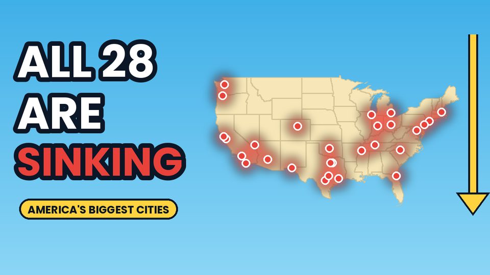
Why America's Biggest Cities Are All Sinking
Sources
| Claim | Source |
|---|---|
| Crews abandoned ships for the gold fields; the Niantic became a store, warehouse and hotel; by 1850 it was 3+ blocks from the water; uncovered several times, most recently 1978, with part of the stern saved; Clay and Sansome | National Park Service |
| Dozens of Gold Rush ships buried under downtown streets | Bunk History (buried-ships map) |
| Bay Area fill over marshes and bay mud; the Marina built for the 1915 exposition partly with 1906 rubble; liquefaction in 1989; hazard maps | KQED |
| Millennium Tower: 58 stories, completed 2009; sank ~16 in by 2016 vs. 4–6 in predicted; ~2 in/yr; friction piles 60–90 ft | GeoEngineer |
| 645 ft tall; ~30 in of tilt over 15 years; 18 perimeter piles socketed 30+ ft into rock ~220 ft down; settlement arrested in 2023 with slight rise | ENR |
| Local zones in San Francisco sinking faster than 5 mm/yr | Columbia Climate School |
| Settling time grows with the square of layer thickness | Standard soil mechanics (Terzaghi consolidation theory) |
| 30 in ÷ 7,740 in ≈ 0.2°; Pisa ≈ 4°; 220 ÷ 90 and 220 ÷ 60; 9 × 5 = 45 years | Worked out on this page |